Search and Rescue Information System (SARIS)
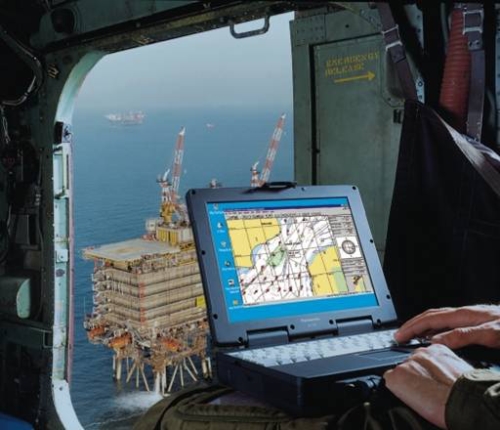 The Search and Rescue Information System (SARIS) version II is the latest generation of information technology for Search and Rescue (SAR), bringing together years of experience gained by the UK Maritime and Coastguard Agency with BMTs expertise in marine environmental software systems. SARIS is an integrated SAR planning tool incorporating both Search Area Determination (SAD) and Search Area Coverage (SAC). It is used internationally, by Coastguards, Navies and Port Authorities, including:
• Maritime and Coastguard Agency (MCA) - UK Coastguard;
• German Sea Rescue Service;
• Royal Navy;
• US Air Force;
• The Netherlands Coastguard;
• Hellenic Coastguard (Greece);
• Danish Navy;
• Greenland Navy;
• Faeroes Pollution Department;
• MRCC Hong Kong;
• New Zealand Marine Safety Agency;
• Guernsey Harbour Authority.
Search Area Determination
The SAD component of the system predicts the movement of a target under the combined action of winds, tides and tidal currents. Using methodologies developed by the UK Maritime and Coastguard Agency, the system establishes the most probable search area based on a range of error and statistical deviations. These include rapid response, datum point, datum line and backtrack search and rescue (SAR) planning methodologies. SARIS has in-built databases of tides, currents, targets leeway and navigational error for rapid model set-up.
Search Area Coverage
Once search areas have been established, SARIS provides the user with a suite of tools for configuring and deploying Search and Rescue Unit's (SRU's) in searching for the lost target(s). These advanced and easy to use graphical tools allow very rapid planning for best use of SAR resources. These SAC tools include the search patterns:
• Creeping line ahead;
• Parallel track; and
• Expanding square.
Sector SARIS seamlessly calculates on the fly, Probability of Detection (POD), track spacing, corrected sweep width, sub-area size etc.
Automatic Import/Met Office Data Import
SARIS has recently been modified to automatically import gridded metocean data in GRIB format. GRIB is an international data format (IMO) used throughout the world by meteorological and oceanographic organisations. Automatic import of this type of data can dramatically increase the system's accuracy and speed up model set-up times.
Complementary Services:
Latest News
- 16/07/2007 BMT Appoints David Sell as Managing Director of BMT Cordah
- 01/05/2007 BMT Provides Support to Chemicals Industry under New EU Regulations
- 13/02/2007 BMT Launches Search and Rescue (SAR) Training Drive
- 10/10/2006 New Head for BMT's Energy and Environment Division
- 09/05/2006 BMT Makes a Noise in Poland
- 15/03/2006 Novatech AS and BMT Cordah Announce Agreement
- 12/01/2006 New Research to Improve Search and Rescue at Sea
- 16/05/2005 BMT to Assess the UK's Ship Recycling Capability